
A field report from Blue Ridge Twin's first major flood — Big Reed Island Creek, Carroll County, VA, August 2, 2026
At 2:05 AM Sunday, every user subscribed to our Big Reed Island Creek sensor got the same push alert: Stage 4 — EVACUATE. Leave creek bottoms now.
Just under five hours later, Big Reed Island Creek near Hillsville, Virginia crested ten feet above normal.
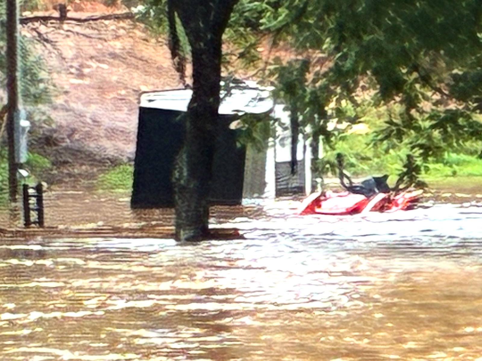
This weekend's flash flooding hit our corner of the Blue Ridge hard — rainfall meteorologists pegged as a 100-year event in the hardest-hit pockets. Mount Airy declared a state of emergency. Roads washed out in two states. One neighbor on Big Reed Island Creek posted his security-camera footage the next morning: “This one caught us all off-guard.”
Our sensor was not caught off-guard. Here is its night, straight from the device logs.
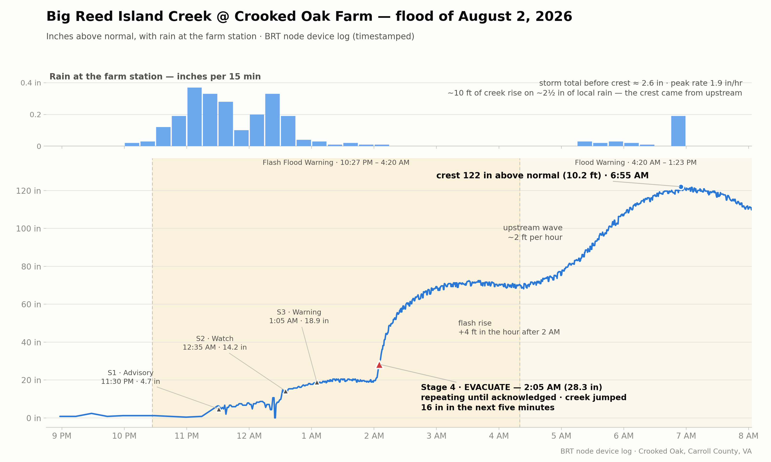
The hardware did everything we designed it to do. Staged alerts fired as specified. Reporting self-escalated from every fifteen minutes to every fifteen seconds as the water rose. Alerts pushed through the whole storm.
The National Weather Service did solid work at county scale all night. A Flash Flood Warning was in effect from 10:27 PM to 4:30 AM. What our node added was the last mile for this creek — the specifics.
This flood was not built by rain in Hillsville. Our rain gauge caught just 2.6 inches in the nine hours before the crest. The water that arrived at 6:55 AM fell miles upstream, hours earlier, on ground where no sensor stands. There were USGS gages on this watershed once; there are none upstream now that could have given warning.
A county-wide flood warning tells you something may be coming. A sensor standing in your creek tells you what is already here — how high, how fast it is rising, and when to get out. That is the gap our node filled.
This is what one sensor can do. But one sensor is a lighthouse. A watershed needs a network. Nodes in the headwaters would have turned the warning our neighbors on Big Reed Island Creek got into warnings for families all through the watershed, and on creeks like this one everywhere.
That is what we are building at Blue Ridge Twin. We are in final talks with our hardware partner, and the first batch of production river-height sensor nodes should be ready soon — designed, built, and priced to give all of Appalachia access to a better flood warning system.
The Hickory Nut Gorge watershed — Bat Cave, Chimney Rock, Lake Lure — and the area around Big Reed Island Creek in Hillsville are the two we are actively pursuing, and we are engaging with landowners now. If you are in either area and want to learn more, want a node from that first batch on a creek on your property, or want to team up with neighbors on a pilot in your county, tell us where you are on the Flood Network page.
Residents along Big Reed Island Creek: our sensor logged this entire flood. If you need water-level documentation for an insurance or FEMA claim, get in touch and we will send it.